
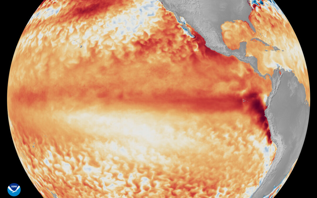
El Niño is strengthening quickly, and the months ahead could bring unusual weather patterns around the world.
The US National Oceanic and Atmospheric Association now gives greater than a 90% chance that the 2026–27 El Niño becomes very strong during the Northern Hemisphere fall and winter, with a 75% chance that its October–December strength reaches a level not observed in the modern record dating back to 1950.
That gets our attention, but it does not tell us exactly what the weather will be at any individual golf course, sports field or turf facility.
El Niño changes the odds. It does not determine the weather at your property.
This article focuses mainly on North America, where most GreenKeeper users are located and where our historical dataset is strongest. The larger lesson applies anywhere: understand how El Niño shifts the probabilities in your region, prepare for the main risks, and then manage the weather you actually receive.
What strong El Niño events have looked like in North America
Strong El Niño winters occurred during 1982–83, 1997–98 and 2015–16, and while were not identical some regional tendencies repeat.
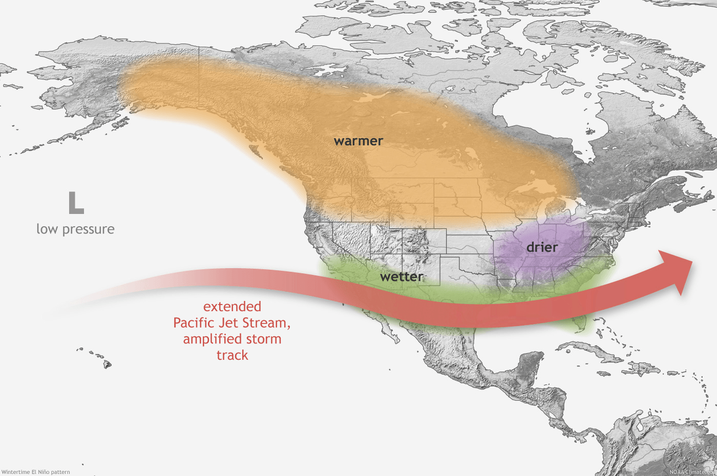
Across the northern United States and southern Canada, winters tend to be milder, often with fewer prolonged periods of severe cold and less persistent snow cover.
Across the southern United States, a stronger subtropical jet often increases the odds of wetter, cooler and cloudier conditions from California and the Southwest through Texas, the Gulf Coast and Southeast. The graphic from NOAA below shows the general trends of winter in North America during an El Niño climate oscillation.
In the North, warmer does not necessarily mean easier. The winters of 2014-15 (strengthening El Niño) and 2015-16 (strong El Niño) were memorable for most turf managers.
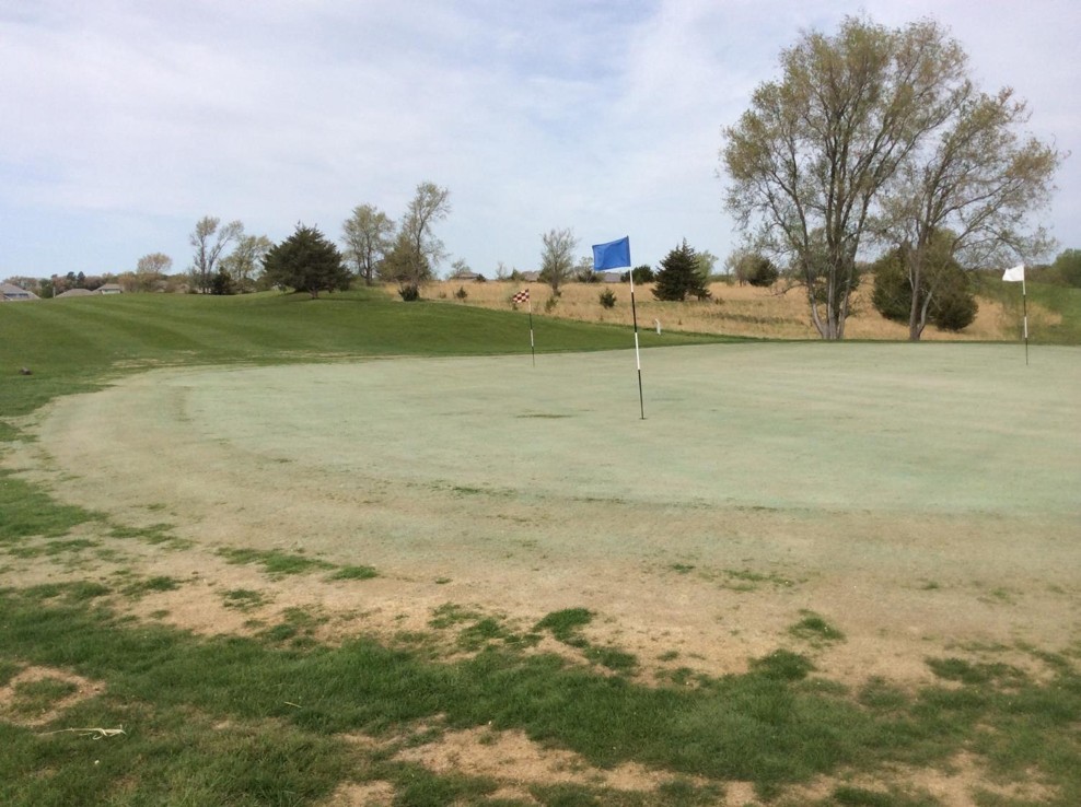
Reduced snow cover can increased winter desiccation across the Great Plains. It was great for my new Nebraska turf research program but not the region’s golf courses. Freeze-thaw cycles can increase crown-hydration risk, especially on annual bluegrass and poorly drained areas. Warm afternoons can also thaw surface soils while deeper layers remain frozen, increasing the potential for traffic or equipment injury. Ice encasement around the Great Lakes is a real concern during this climate pattern.
A mild winter can also bring a surprisingly early spring. Turf growth, disease development, insects and plant indicators used for application timing can all move weeks ahead of the calendar.
For northern managers, that means being ready earlier than normal. Calibrate sprayers, watch GDD accumulation, organize scouting methods and have equipment ready before the traditional start of the season.
In the South, prepare for water and low light.
From California through the Southwest, Texas, Gulf Coast and Southeast, the concern may be repeated rainfall, saturated soils and prolonged cloudy weather.
For warm-season turf, the combination of cool temperatures, wet soils and low light can be especially stressful. Photosynthesis declines, root-zone oxygen becomes limited, recovery slows and disease pressure can increase.
That may require changes in management intensity rather than wholesale changes in the program. Maintaining more leaf area, reducing unnecessary mowing stress, improving aeration, managing traffic and adjusting plant-protection intervals can all become more important.
Now is the time to inspect drainage and identify the areas most likely to become problematic during extended wet periods.
A North American forecast should not simply be exported around the world.
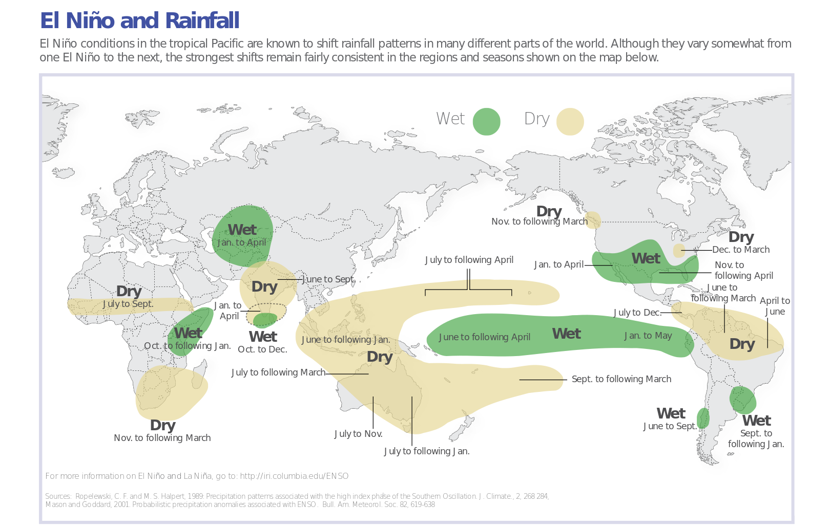
In Australia, for example, El Niño increases the likelihood of drier winter and spring conditions across eastern half of the continent. Golf course superintendents can expect warmer daytime temperatures and greater frost risk with the drier humidity. Turf managers should plan around water availability, irrigation efficiency, drought stress and management practices to maximize heat.
Other regions have their own ENSO relationships. The above figure from Columbia University represents these climate modifications well. Remember that climate is different than weather. All types of weather events can occur on a given day, where climate represents long-term trends in weather patterns.
Climate Probabilities are Still Valuable
Recent examination of the California weather pattern during El Nino years shows how climate probabilites might not always come to fruition.
Many strong El Niño years have produced exceptionally wet California winters. Others have not. During the 2023–24 El Niño, GreenKeeper courses in California actually received less precipitation than during the preceding La Niña winter because 2022–23 had already delivered an extraordinary series of atmospheric rivers.
That does not make the El Niño signal useless. It means managers should prepare for a wet winter without assuming one is guaranteed.
Prepare for scenarios, then manage around the weather that you’ve been dealt.
Prepare now for the possibility of atypical weather and climate this winter.
In northern North America, that may mean a shorter winter and earlier spring. Across the southern United States, it may mean cool, cloudy and wet periods. In parts of Australia and other regions, the greater concern may be dryness, heat or increasing irrigation demand.
Then watch what happens locally.
ENSO tells us how climate probabilities are shifting. Local temperature, rainfall, soil conditions and plant response still determine the turf-management decision.
To learn more about abiotic stress management, consider enrolling in the GreenKeeper University course – Causes and Management of Turf Stress.

COMING NEXT TIME
GreenKeeper has weather and application records from hundreds of North American golf courses during the last strong El Niño. In the next article in our El Niño Series, we will look at what managers actually did during 2023–24—and what those records suggest you should be ready for this time.
The preview: Managers did not dramatically change the products they used. They changed when they used them.